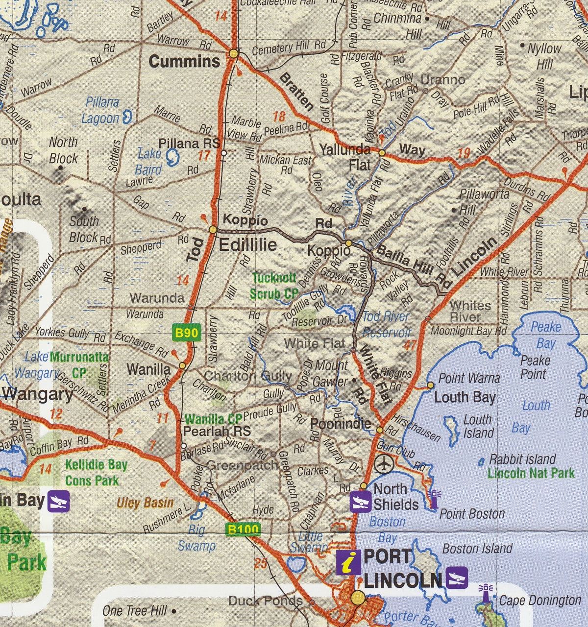
Eyre Peninsula Carto Graphics Map
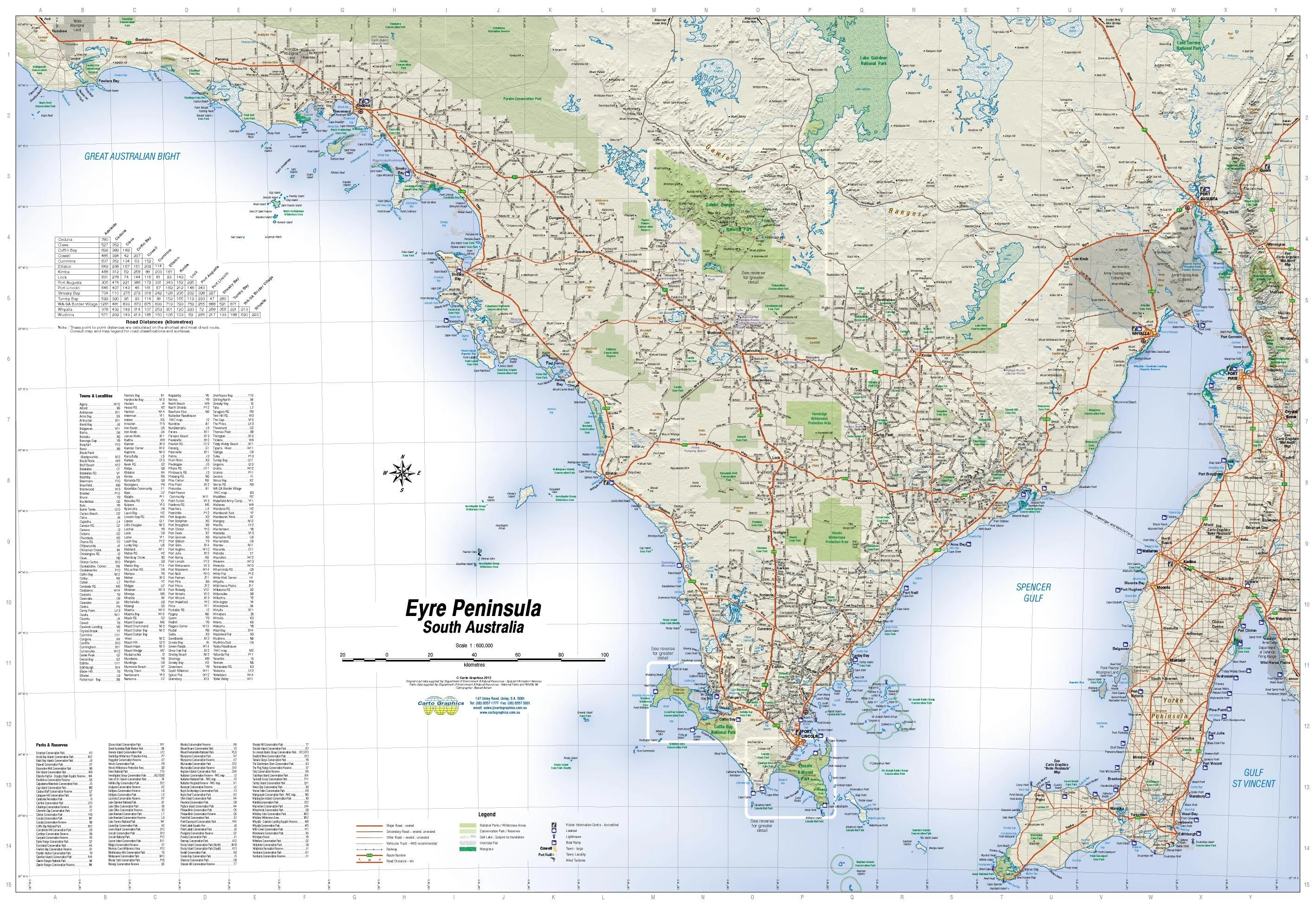
🦘 Eyre Peninsula Touring Map – Carto Graphics
Includes Coffin Bay, Gawler Ranges & Lincoln National Parks
Scale: 1:600,000 | Size: 1000 × 690 mm
🗺️ Available folded or as a flat laminated wall map
Explore South Australia's rugged and remote west coast with the Eyre Peninsula Touring Map by Carto Graphics — a detailed and easy-to-read travel companion covering the vast triangle of land from Port Wakefield to Ceduna, including scenic coastline, national parks, and regional towns.
Whether you're planning a seafood trail through Port Lincoln, a surf trip along the wild southern beaches, or a 4WD journey into the Gawler Ranges, this map gives you the clarity and detail needed to travel with confidence.
📍 Coverage Area
| Region | Highlights |
|---|---|
| Northern Boundary | Port Wakefield |
| Western Limit | Ceduna & Far West Coast |
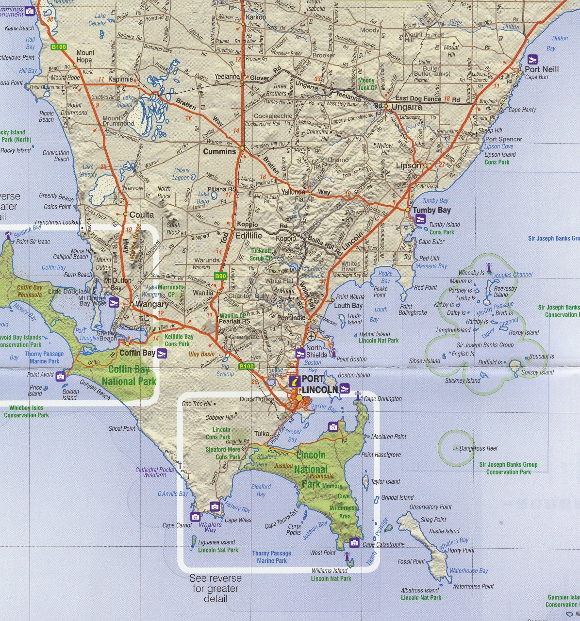
| Southern Features | Port Lincoln, Coffin Bay, Lincoln National Park |
| Interior Routes | Wudinna, Gawler Ranges, Iron Knob, Kimba, Cowell |
🗺️ Inset Maps on Reverse Side
Includes 4 focused inset maps with greater detail for key park and wilderness areas:
-
🌿 Coffin Bay National Park – Scale 1:150,000
-
🏞️ Gawler Ranges National Park – Scale 1:150,000
-
🌊 Lincoln National Park – Scale 1:150,000
-
🌾 Far West Coast (west of Ceduna to the WA border) – Scale 1:600,000
These inset maps highlight trails, 4WD routes, campgrounds, and natural features in each park.
🧭 Key Features
| ✅ Feature | 📍 Description |
|---|---|
| 🛣️ Clear Road Mapping | Shows highways, regional roads, minor routes, and access to remote parks |
| 🏕️ Campgrounds & Parks | National parks, conservation areas, and camping zones are clearly shaded and marked |
| 🛤️ 4WD Tracks & Trails | Ideal for off-road travellers looking to explore coastal and inland trails |
| 🐟 Fishing & Coastal Access | Discover top fishing spots, jetties, and boat ramp access |
| 📍 Towns & Localities Index | Handy for route planning and travel stops |
| 🍽️ Seafood & Visitor Trail | Covers key coastal towns known for oysters, tuna, and other regional produce |
📐 Map Specifications
| Specification | Detail |
|---|---|
| Publisher | Carto Graphics |
| Title | Eyre Peninsula Map |
| Main Scale | 1:600,000 |
| Inset Scales | 1:150,000 (x3), 1:600,000 (Far West Coast) |
| Map Size | 1000 mm (W) × 690 mm (H) |
| Printed in | Australia |
| Format Options | Folded paper OR laminated flat |
🧴 Optional Laminated Version
Want a more durable and reusable version for planning or display?
-
✅ Laminated flat map is encapsulated in 80-micron gloss laminate
-
✅ Marker-friendly – use whiteboard markers for planning routes or marking stops
-
✅ Water and tear-resistant – ideal for use in vehicles, campsites, or on the road
Note: This version is made by flattening the folded map before lamination. Minor fold lines may remain visible.
🏞️ Perfect For:
-
🛻 Road trippers travelling from Adelaide to Ceduna or across the Nullarbor
-
🥾 Hikers and campers exploring Coffin Bay, Lincoln, or Gawler Ranges National Parks
-
🐟 Fishermen, surfers, and coastal travellers seeking hidden coves and local seafood gems
-
🧭 4WD adventurers planning off-grid travel into remote Eyre Peninsula
-
📦 Delivery drivers and local businesses covering the western SA region
🛒 Add to Cart – Start Your Eyre Peninsula Journey Here
Whether you're tracking sand dunes, hiking coastal cliffs, or sipping oysters in Coffin Bay, this detailed map will help guide you through one of Australia’s most underrated road trip destinations.
✅ Select folded or laminated format at checkout
Looking for more? Pair it with:
-
Nullarbor Plain (Perth to Adelaide) Map
-
Flinders Ranges Touring Map
-
South Australia State Handy Map
Original: $10.83
-65%$10.83
$3.79Product Information
Product Information
Shipping & Returns
Shipping & Returns
Description
🦘 Eyre Peninsula Touring Map – Carto Graphics
Includes Coffin Bay, Gawler Ranges & Lincoln National Parks
Scale: 1:600,000 | Size: 1000 × 690 mm
🗺️ Available folded or as a flat laminated wall map
Explore South Australia's rugged and remote west coast with the Eyre Peninsula Touring Map by Carto Graphics — a detailed and easy-to-read travel companion covering the vast triangle of land from Port Wakefield to Ceduna, including scenic coastline, national parks, and regional towns.
Whether you're planning a seafood trail through Port Lincoln, a surf trip along the wild southern beaches, or a 4WD journey into the Gawler Ranges, this map gives you the clarity and detail needed to travel with confidence.
📍 Coverage Area
| Region | Highlights |
|---|---|
| Northern Boundary | Port Wakefield |
| Western Limit | Ceduna & Far West Coast |
| Southern Features | Port Lincoln, Coffin Bay, Lincoln National Park |
| Interior Routes | Wudinna, Gawler Ranges, Iron Knob, Kimba, Cowell |
🗺️ Inset Maps on Reverse Side
Includes 4 focused inset maps with greater detail for key park and wilderness areas:
-
🌿 Coffin Bay National Park – Scale 1:150,000
-
🏞️ Gawler Ranges National Park – Scale 1:150,000
-
🌊 Lincoln National Park – Scale 1:150,000
-
🌾 Far West Coast (west of Ceduna to the WA border) – Scale 1:600,000
These inset maps highlight trails, 4WD routes, campgrounds, and natural features in each park.
🧭 Key Features
| ✅ Feature | 📍 Description |
|---|---|
| 🛣️ Clear Road Mapping | Shows highways, regional roads, minor routes, and access to remote parks |
| 🏕️ Campgrounds & Parks | National parks, conservation areas, and camping zones are clearly shaded and marked |
| 🛤️ 4WD Tracks & Trails | Ideal for off-road travellers looking to explore coastal and inland trails |
| 🐟 Fishing & Coastal Access | Discover top fishing spots, jetties, and boat ramp access |
| 📍 Towns & Localities Index | Handy for route planning and travel stops |
| 🍽️ Seafood & Visitor Trail | Covers key coastal towns known for oysters, tuna, and other regional produce |
📐 Map Specifications
| Specification | Detail |
|---|---|
| Publisher | Carto Graphics |
| Title | Eyre Peninsula Map |
| Main Scale | 1:600,000 |
| Inset Scales | 1:150,000 (x3), 1:600,000 (Far West Coast) |
| Map Size | 1000 mm (W) × 690 mm (H) |
| Printed in | Australia |
| Format Options | Folded paper OR laminated flat |
🧴 Optional Laminated Version
Want a more durable and reusable version for planning or display?
-
✅ Laminated flat map is encapsulated in 80-micron gloss laminate
-
✅ Marker-friendly – use whiteboard markers for planning routes or marking stops
-
✅ Water and tear-resistant – ideal for use in vehicles, campsites, or on the road
Note: This version is made by flattening the folded map before lamination. Minor fold lines may remain visible.
🏞️ Perfect For:
-
🛻 Road trippers travelling from Adelaide to Ceduna or across the Nullarbor
-
🥾 Hikers and campers exploring Coffin Bay, Lincoln, or Gawler Ranges National Parks
-
🐟 Fishermen, surfers, and coastal travellers seeking hidden coves and local seafood gems
-
🧭 4WD adventurers planning off-grid travel into remote Eyre Peninsula
-
📦 Delivery drivers and local businesses covering the western SA region
🛒 Add to Cart – Start Your Eyre Peninsula Journey Here
Whether you're tracking sand dunes, hiking coastal cliffs, or sipping oysters in Coffin Bay, this detailed map will help guide you through one of Australia’s most underrated road trip destinations.
✅ Select folded or laminated format at checkout
Looking for more? Pair it with:
-
Nullarbor Plain (Perth to Adelaide) Map
-
Flinders Ranges Touring Map
-
South Australia State Handy Map