France Loire 517 Michelin Map
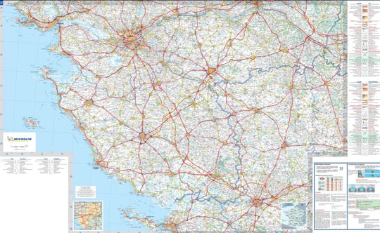
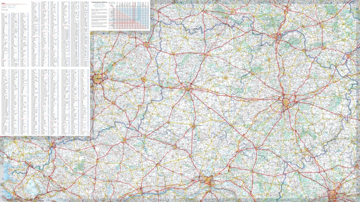
🇫🇷 Michelin Regional Map 517 – Pays de la Loire (Loire Region)
Scale: 1:200,000 | Size: 1200 x 1000 mm | Folded Paper Map
Explore the châteaux, rivers, vineyards, and Atlantic coastline of the Loire with Michelin’s legendary cartographic detail.
🗺️ Your Essential Travel Companion to the Loire Valley & Beyond
Whether you're gliding past grand Renaissance castles, sipping Sauvignon in Saumur, or basking in the sea breeze along the Vendée coast, the Michelin Pays-de-la-Loire Regional Map (517) is the perfect guide to navigate one of France’s most beloved and varied regions.
This map covers Pays de la Loire, including parts of Brittany, Centre-Val de Loire, and Nouvelle-Aquitaine, offering detailed, accurate mapping ideal for road trips, walking tours, and heritage travel.
🌟 Map Highlights
| Feature | Description |
|---|---|
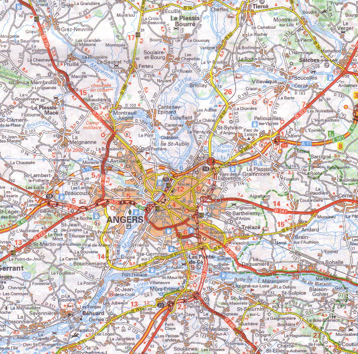
| 🛣️ Comprehensive Road Detail | Motorways, national and regional roads, scenic routes, and all road classifications clearly marked |
| 🏞️ Tourist Sites & Scenic Routes | Castles, vineyards, natural parks, picturesque villages, and historical landmarks shown |
| 🏙️ Urban Insets | Includes detailed town plans of major cities and travel hubs |
| 📍 Indexed Place Names | Easy-to-use alphabetical index for locating towns and villages |
| ⏱️ Travel Tools | Distance chart and driving time table for better route planning |
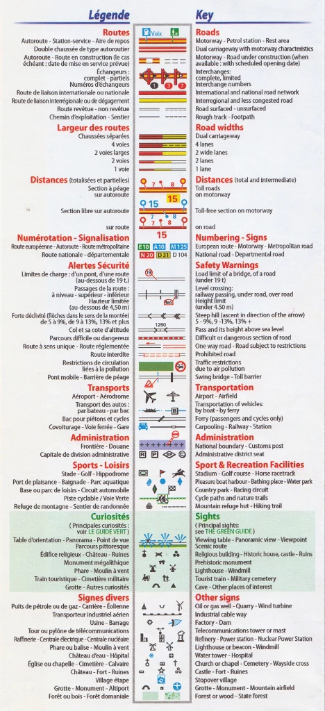
| 🌐 Multilingual Map Legend | Key in English, French, German, Spanish, and Italian |
📌 Coverage Includes:
-
Nantes, Angers, Le Mans, Saumur, Cholet, La Roche-sur-Yon, and Saint-Nazaire
-
Major cultural sites like the Château de Brissac, Abbaye de Fontevraud, and Château de Saumur
-
The Loire River valley, a UNESCO World Heritage corridor dotted with vineyards and Renaissance estates
-
The Atlantic coast, including Les Sables-d’Olonne, Pornic, and Noirmoutier
📐 Product Specifications
| Specification | Detail |
|---|---|
| Map Title | France Loire – Michelin Regional Map 517 |
| Map Scale | 1:200,000 (1 cm = 2 km) |
| Unfolded Size | 1200 mm x 1000 mm |
| Map Type | Folded paper map |
| Place Names | In local language as seen on road signs |
| Legend Languages | English, French, Spanish, German, Italian |
🧳 Perfect For:
✅ Self-drive travellers exploring the Loire Valley or Atlantic coast
✅ Heritage lovers seeking castles, abbeys, and historic towns
✅ Wine tourists following the Loire wine trail
✅ Outdoor adventurers cycling or walking along rivers and trails
✅ Families & campers visiting the region’s beaches and villages
🏅 Why Choose Michelin?
Michelin’s maps are the gold standard for European travel — prized for their accuracy, clarity, and usability. With this regional edition, you'll have not only precise road detail but also a wealth of tourist and travel information to enhance your experience.
📦 Shipping Information
Ships from Australia.
Fast dispatch — most orders sent next business day.
🌿 Journey Through the Heart of France
With its regal châteaux, fertile vineyards, charming cities, and Atlantic breezes, the Loire region is an unforgettable part of France. This Michelin map helps you make the most of it, one scenic route at a time.
Plan confidently. Travel intelligently. Explore deeply — with Michelin
Original: $15.91
-65%$15.91
$5.57Product Information
Product Information
Shipping & Returns
Shipping & Returns
Description
🇫🇷 Michelin Regional Map 517 – Pays de la Loire (Loire Region)
Scale: 1:200,000 | Size: 1200 x 1000 mm | Folded Paper Map
Explore the châteaux, rivers, vineyards, and Atlantic coastline of the Loire with Michelin’s legendary cartographic detail.
🗺️ Your Essential Travel Companion to the Loire Valley & Beyond
Whether you're gliding past grand Renaissance castles, sipping Sauvignon in Saumur, or basking in the sea breeze along the Vendée coast, the Michelin Pays-de-la-Loire Regional Map (517) is the perfect guide to navigate one of France’s most beloved and varied regions.
This map covers Pays de la Loire, including parts of Brittany, Centre-Val de Loire, and Nouvelle-Aquitaine, offering detailed, accurate mapping ideal for road trips, walking tours, and heritage travel.
🌟 Map Highlights
| Feature | Description |
|---|---|
| 🛣️ Comprehensive Road Detail | Motorways, national and regional roads, scenic routes, and all road classifications clearly marked |
| 🏞️ Tourist Sites & Scenic Routes | Castles, vineyards, natural parks, picturesque villages, and historical landmarks shown |
| 🏙️ Urban Insets | Includes detailed town plans of major cities and travel hubs |
| 📍 Indexed Place Names | Easy-to-use alphabetical index for locating towns and villages |
| ⏱️ Travel Tools | Distance chart and driving time table for better route planning |
| 🌐 Multilingual Map Legend | Key in English, French, German, Spanish, and Italian |
📌 Coverage Includes:
-
Nantes, Angers, Le Mans, Saumur, Cholet, La Roche-sur-Yon, and Saint-Nazaire
-
Major cultural sites like the Château de Brissac, Abbaye de Fontevraud, and Château de Saumur
-
The Loire River valley, a UNESCO World Heritage corridor dotted with vineyards and Renaissance estates
-
The Atlantic coast, including Les Sables-d’Olonne, Pornic, and Noirmoutier
📐 Product Specifications
| Specification | Detail |
|---|---|
| Map Title | France Loire – Michelin Regional Map 517 |
| Map Scale | 1:200,000 (1 cm = 2 km) |
| Unfolded Size | 1200 mm x 1000 mm |
| Map Type | Folded paper map |
| Place Names | In local language as seen on road signs |
| Legend Languages | English, French, Spanish, German, Italian |
🧳 Perfect For:
✅ Self-drive travellers exploring the Loire Valley or Atlantic coast
✅ Heritage lovers seeking castles, abbeys, and historic towns
✅ Wine tourists following the Loire wine trail
✅ Outdoor adventurers cycling or walking along rivers and trails
✅ Families & campers visiting the region’s beaches and villages
🏅 Why Choose Michelin?
Michelin’s maps are the gold standard for European travel — prized for their accuracy, clarity, and usability. With this regional edition, you'll have not only precise road detail but also a wealth of tourist and travel information to enhance your experience.
📦 Shipping Information
Ships from Australia.
Fast dispatch — most orders sent next business day.
🌿 Journey Through the Heart of France
With its regal châteaux, fertile vineyards, charming cities, and Atlantic breezes, the Loire region is an unforgettable part of France. This Michelin map helps you make the most of it, one scenic route at a time.
Plan confidently. Travel intelligently. Explore deeply — with Michelin